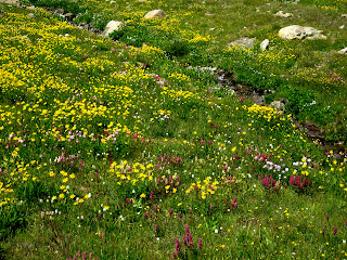
Lost Creek Wilderness {November 2011}

Labels

14ers (4) California (9) camping (23) Colorado (13) Family (2) Grand Canyon (7) Half Dome (5) Hiking (11) Italy (2) Medical School (3) Music (3) Notre Dame (2) Of random interest (3) Opinion (3) Photos (3) Poetry (1) Recipes (1) Snowshoeing (1) South Dakota (2) Travel (21) Utah (1)
Showing posts with label 14ers. Show all posts

Thursday, August 18, 2011

Handies Peak {14,048'}

The Basics ...


Handies Peak; San Juan Range


Date climbed: Saturday, August 13th
Elevation: 14,048'
Route: East slopes from Grizzly Gulch; elevation gain of 3,650'
RT distance & time: 8 miles; nearly 7 hours (including at least an hour spent on the summit and 30 minutes or so photographing meadow wildflowers ... we were blessed with a picture-perfect day and beautiful weather, so why rush?)


Handies from Grizzly Gulch (around 11,800')
Justin, Kona and I left the city on Friday morning en route to the lovely San Juans (a place neither of us had visited) with the intention of climbing Handies, Redcloud & Sunshine over two days. From Lake City, we drove 16 miles on County Road 30 towards Cinnamon Pass along a well-maintained dirt road that eventually hugs the south side of Sunshine Peak (with a bit of exposure) as it nears the Grizzly Gulch/Silver Creek trailhead. Comparatively, this road is quite smooth - 2WD vehicles shouldn't have much of an issue making it all the way to the TH given favorable weather. Since the area containing the parking lot is pretty open, we continued past the trailhead a half mile and chose a more secluded campsite with a stunning view of Redcloud and Sunshine. Since it was only 4:45 pm, we had plenty of time to play a game of bocce, prepare and eat chicken fajitas, enjoy a Moose Drool or two, and watch the full moon rise over Sunshine. The rain was supposed to stay away until the next evening, so we opted to forgo the rainfly.


We weren't on the Grizzly Gulch trail until 9 am the following morning ... luckily the forecast was promising and the hike relatively easy. Once we neared 11,500', we had a perfect view of our peak for the remainder of the ascent; we were also surrounded by the most incredible concentration and variety of wildflowers I have ever seen in one place! The final miles of our hike were unremarkable, but I should mention that the upper North Ridge is comprised of scree and loose rock which, because it is the steepest section of trail, makes it somewhat difficult to climb (although the descent is a bit more challenging). --- And by 'challenging', I mostly mean annoying --- The views from the summit of Handies are remarkable; despite being entirely unfamiliar with the San Juans, I could easily recognize Wetterhorn and Uncompahgre to the north as well as Mount Sneffels to the northwest.


Wetterhorn (left) and Uncompahgre
Kona on the summit of his third 14er


This was the most gorgeous hike I have ever been on .... Handies Peak was #18 for me, #15 for Justin and #3 for Kona. Grizzly Gulch is not a difficult route by any means, so we were able to enjoy ourselves while accomplishing a noteworthy feat! Unfortunately, due to stormy morning weather that persisted throughout the day, we were unable to attempt Redcloud and Sunshine on Sunday. Yet, if we had to return anywhere to check off a few peaks, it'd definitely be here! Someday :)


Tuesday, July 5, 2011

La Plata Peak {14,336'}

La Plata Peak {The Silver Peak}; Sawatch Range
Elevation: 14,336’
Route: Southwest Ridge
RT distance & time: 7 miles; 6.5 hours (including photo & rest breaks, plus summit time)

Monument Plant (green gentian): flowers only once in it's 80-year lifespan
Located in the Sawatch Range between the towns of Leadville and Buena Vista, La Plata Peak is the 5th highest mountain in Colorado at 14,336 feet in elevation. Its name means ‘silver’ in Spanish, which is likely due to the silver deposits found in the area as well as the nearby silver mining ghost towns of Winfield and Hamilton. I have to say, besides sunrise on top of Mount Belford, this was my favorite fourteener hike to date. I am also happy to report that we did not encounter any navigational issues which, after Humboldt last month, made for a relaxing and stress-free climb. La Plata was #17 for me, #14 for Justin, and #2 for Kona, who just turned one year.

Since it was Fourth of July weekend, one of the busiest in the high-country, we decided to climb La Plata via the slightly less popular Southwest Ridge route. We also opted not to camp the night prior to our hike, which is unusual for us. The dirt road to the trailhead requires a high-clearance vehicle and attentive driving to avoid significant potholes, ruts, and rocks … and to arrive at the trailhead without making any wrong turns. The trail is somewhat steep at the outset as it follows a stream but, quite quickly, we reached an expansive meadow above treeline with a view of the ridge. Here, we encountered willows, snow fields, water, and a muddy mess; Kona loved it. Upon reaching the ridge ascent, we decided to follow an alternate path upwards. Though steep, our route was quick and did indeed connect us to the ridge at a point closer to our next uphill goal.

Justin in the muddy willow basin; SW ridge view
Kona in the stream that parallels the trail


As we began switchbacking and boulder hopping up the north/northeast slope, several people were heading down; one guy informed us that storms were building on the east side of the peak, and that we were still an hour and a half from the unseen summit. Justin and I looked at each other with an unspoken agreement that we would continue unless conditions became sketchy (this turned out to be an excellent judgment call). From here, it probably took us an hour to reach the summit, and skies were clear and blue above us. I could see darker clouds surrounding Huron to the south, but we were in a perfect pocket of sunshine complete with superb 360 degree views and summit solitude. 


We cheers’d (can you make that into a verb?) to cooperative weather and the serenity atop Colorado’s 5th highest peak with a Samurai rice ale compliments of Great Divide. I’m not sure anything can top the views from La Plata – we could see Elbert and Massive directly to the north; Huron, Missouri, Belford, and Oxford directly to the south (as well as Yale, Columbia, and Harvard in the distance); and even the Elks to the west. 


Just as we were preparing to depart, two guys arrived from the Northwest Ridge route. They were very friendly, and it was nice to chat with them for a few minutes; they’d begun hiking at 5:30 that morning and finally made it to the summit around 2:00pm - talk about a long day! Fortunately, the route down was uneventful for us; Justin fell on his ass twice descending the “normal” trail back into the basin, and I slid once into a dense collection of willows. Perhaps this section of trail is in need of some maintenance … Kona was excited to play in the mud once again, and the car was right where we left it when we returned. Most likely a result of climbing Half Dome two weeks ago, as well as backpacking a decent number of miles throughout Yosemite, I felt in great physical condition and my legs still have not succumbed to post-climb soreness. All in all, one of the more pleasant hikes … and undoubtedly the best views!

Alpine flowers along the ridge (Sayres Benchmark is the prominent peak)

On a more serious note: I am sincerely sad to hear about the recent deaths of Makana and Michael Von Gortler on Missouri Mountain (a 14er within a few miles of La Plata). This news is truly heartbreaking, but it’s also terrifyingly relevant to me and all other backcountry hikers. Something like this can happen to anyone at any given time on these peaks regardless of experience level … simply put, nature always wins … especially above 14,000’. Not only must we respect our own limits, but we must respect the mountain and understand that we are temporary and greatly inferior visitors. Four deaths within a week on our peaks …Rough start to the season before it’s even officially begun. Prayers and prayers.

… Hopefully I can now find motivation to write about ten days in the Sierra Nevada …

Monday, June 6, 2011

Humboldt Peak {14,064'}

Lesson learned: Even on climbs that appear straightforward, STUDY YOUR ROUTE!

It never crossed my mind that to reach the summit of Humboldt, a fourteen-thousand {plus} foot peak in the Sangre de Cristo range, we would have to bushwhack our way up the east ridge without the guidance of a trail. Thus, as a consequence of getting somewhat disoriented, we likely added an additional four miles on top of the round-trip eight .... and our day was completely consumed with frustration and exhaustion from climbing this mountain. Yet, sweet summit success and a checkmark next to #16!


My boy, my pup, and I drove south from Denver at 2:30 Friday afternoon to the Sangre de Cristos, near Westcliffe. Although it was nowhere on my radar (nor my original list), we chose Humboldt because it was least likely to have significant snowpack this early in the season and it's one of the easier peaks, comparatively, (which was beneficial for two out-of-shape individuals and an 11-month old pup's first 14er attempt). The road up to the Rainbow Trailhead was a bit rough; I probably wouldn't recommend it for 2WD cars. We chose a perfect campsite and, since June is somewhat early to climb mountains, we really didn't encounter any people. Following dinner, a game of bocce, some guitar playing, and several shots of rum (Justin's contribution from Grenada), we were all fast asleep.


I thought that printing the route description out and bringing it along would have been enough to keep us on track .... however we soon ended up two miles too far on the Rainbow trail; apparently we missed our unmarked cutoff. I didn't even know it was unmarked! Turns out, I really didn't do a good job of researching the route at all. Instead of backtracking the entire way, we began our steep and rather sideways ascent of the northeast ridge. Eventually it connected to the east ridge and, after passing through several snowfields, we made our way above treeline. Our next goal? A massive grassy incline, at the top of which we finally had a view of the summit (so damn far away, as always).


In reality, it didn't take too much time to gain the summit from this point. We did descend a bit to the left of the ridgeline in an effort to avoid snowfields on steep terrain, which resulted in a pain in the ass (literally) climb up near the end. It was so windy on the summit that we probably lasted 15 minutes before starting back down {enough time for Kona to take a nap, and for Justin and I to share a victory amber ale before snapping a few photos}.


The Crestones
Kona's first 14er!
Despite having a clear view of the east ridge that would lead us back to the Rainbow Trailhead and our car, we managed to complicate the situation. Somehow, we hiked much further south than intended ... and seriously struggled to return before darkness set in. During the ordeal, I may have shed a few tears of frustration, my sunglasses succumbed to the South Colony Creek, we were forced to cross the damn water three times (after arriving on an island by mistake), and my feet and legs were ridiculously sore from navigating over rocks and becoming ensnared in brambles and thorny bushes. All this time, unbeknownst to me (thank God), Justin was worried about disturbing unsuspecting moose in their swampy territory. Finally .... finally .... we stumbled across the trail and, soon after, our car; a most welcome sight. It was completely dark by this point. I am happy that our efforts paid off in summit success, but lesson learned: Even on climbs that appear straightforward, STUDY YOUR ROUTE!

Saturday, February 5, 2011

The Eleven

I'm thinking that my fourteener approach may be slightly misguided. I'm actually surprised it took me this long to realize, especially after Capitol last August.

Already, I have eleven peaks on my list for this year.


Longs Peak
Snowmass
Pikes Peak
Crestones
Sunshine/Redcloud
Shavano/Tabeguache
Evans/Sawtooth/Bierstadt


It's certainly not the most challenging combination I could have come up with. But, taking variables such as weather, terrain, and season into account, you could convincingly argue that no fourteener is a safe bet. I considered adding Capitol to my lineup, but I can't bring myself to face that mountain again ... not yet. My palms get sweaty just thinking about it. Last week, I read about Christy Mahon from Aspen, who became the first woman - and the seventh person - to hike up and ski down all 54 of Colorado's fourteeners. Her final peak? Capitol. Yikes! Below is a photo of Capitol's summit ridge {class 4} from my trip in late August of 2010.


I've always thought of these peaks as conquests, like a temporary assertion of my dominance over nature. Yea right! This year, the eleven cataloged above will be regarded as opportunities rather than goals to be achieved or items to be checked off a list (of course, they will still be checked off a list ....) Fortunately, I've only had to turn back from a summit attempt twice, on Elbert and Capitol. While this may feel like failure, the reality is that nature wins - always - and the mountain will still be there, daring you to return. Another opportunity awaits on every occasion.